Tulsa's subsurface tells a story that only a full particle-size distribution can read. From the lean clays of the Foyil series to the silty sands left by historic Arkansas River meanders, what you see in a split spoon rarely matches what the hydrometer reveals. In our experience, contractors assume a clean sand at eight feet only to hit a gap-graded silt that drains poorly and complicates footing design. We run the complete grain size analysis — sieve stack plus hydrometer sedimentation — because Unified Soil Classification demands the full curve, not just the coarse fraction. When the fines content hovers near the 12 percent threshold that separates SW from SM under ASTM D2487, missing the hydrometer can shift the entire seismic site class and double your foundation costs. For deeper exploration where grain size alone is insufficient, combining results with SPT drilling data provides the strength parameters needed for bearing capacity calculations in Tulsa County.
The hydrometer catches the 12 percent fines threshold that a visual classification misses — and in Tulsa, that threshold determines whether your site is Class C or Class D.
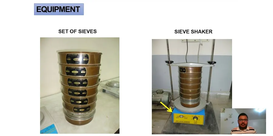
Methodology and scope
Local considerations
Downtown Tulsa and the Pearl District sit on Pleistocene terrace deposits with low fines content and rapid drainage — the kind of soil where a sieve-only analysis might suffice for a shallow footing. Drive fifteen minutes south to the Bixby area along the Arkansas River, and you encounter overbank silts with 30 to 60 percent passing the No. 200, where the hydrometer suddenly becomes the most critical data point in the report. We have seen projects where the geotechnical report classified a soil as SM based on visual inspection, only for the hydrometer to reveal 18 percent clay fraction — pushing it into SC territory with entirely different compaction characteristics and much lower permeability. The cost of that misclassification shows up in pavement subgrade failures, retaining wall drainage problems, and post-construction settlement that no amount of re-compaction can fix. For sites near the Mingo Valley fault zone, grain-size distribution directly feeds into liquefaction susceptibility screening under the simplified procedure — if the fines content and clay fraction exceed the criteria in Seed and Idriss, the project may avoid costly ground improvement altogether.
Explanatory video
Applicable standards
ASTM D6913-17 — Standard Test Methods for Particle-Size Distribution (Gradation) of Soils Using Sieve Analysis, ASTM D7928-21 — Standard Test Method for Particle-Size Distribution (Gradation) of Fine-Grained Soils Using the Sedimentation (Hydrometer) Analysis, ASTM D2487-17 — Standard Practice for Classification of Soils for Engineering Purposes (Unified Soil Classification System), AASHTO T 88-22 — Particle Size Analysis of Soils
Associated technical services
Full PSD Package (Sieve + Hydrometer)
Complete mechanical sieve analysis per ASTM D6913 from 75 mm down to 75 μm, followed by hydrometer sedimentation per ASTM D7928. Delivers the full particle-size curve with D10, D30, D60, coefficients of uniformity and curvature, and USCS classification per ASTM D2487. Recommended for all sites with visible fines or where seismic site class depends on fines content.
Hydrometer-Only Analysis for Fine-Grained Soils
For samples where the coarse fraction is negligible or already characterized, we run the sedimentation analysis standalone using a 152H hydrometer with temperature correction and meniscus adjustment. Reports percent clay, silt, and sand fractions along with the fine portion of the PSD curve — ideal for borrow source evaluation and clay liner permeability assessment.
Combined PSD with Atterberg Limits and Moisture Content
A bundled package that pairs the full grain-size distribution with liquid limit, plastic limit, and plasticity index per ASTM D4318, plus natural moisture content. The combination provides everything needed for USCS classification with group name, soil activity calculation, and preliminary assessment of shrink-swell potential in Tulsa's clay-rich residual soils.
Typical parameters
Frequently asked questions
Why do I need a hydrometer analysis if the sieve already shows the gradation?
The sieve stops at the No. 200 mesh (75 μm) — anything finer passes through uncounted. In Tulsa's alluvial and residual soils, the silt and clay fraction often controls permeability, compressibility, and shear strength. Without the hydrometer, you cannot distinguish between a well-graded sand with silt (SW-SM) and a true silty sand (SM) under ASTM D2487, and you lose the data needed for liquefaction screening and frost susceptibility evaluation.
How much sample material do you need for a complete grain size analysis?
For the combined sieve and hydrometer test, we typically need 500 to 1,000 grams of dry soil if the maximum particle size is under 3/8 inch. For samples containing gravel up to 3 inches, we require 3,000 to 5,000 grams. The hydrometer portion requires only about 50 grams of the minus-No. 200 material, which we obtain by wet-sieving the bulk sample. We always retain the coarse fraction for oven-drying and weighing.
What does a grain size analysis cost in Tulsa?
A complete sieve plus hydrometer analysis typically ranges from US$110 to US$180 per sample, depending on whether the sample requires extensive pre-processing (drying, disaggregation, wet sieving to separate the fines) and whether you need the full report with USCS classification and commentary. Hydrometer-only runs are at the lower end of that range.
How long does the hydrometer test take from start to finish?
The sedimentation phase itself runs a minimum of 24 hours, with readings at 15, 30, 60, 120, 240, and 1440 minutes after mixing. Including sample preparation — drying, weighing, soaking in dispersant, mechanical dispersion, and transferring to the sedimentation cylinder — the complete hydrometer analysis takes two to three working days from sample receipt to final report.
Can grain size results tell me if my soil is suitable for compacted fill?
Partially. The grain-size curve shows you whether the material is well-graded (Cu > 6 for sands, Cu > 4 for gravels) and whether the fines content falls in a range suitable for compaction. But grain size alone cannot predict maximum dry density or optimum moisture — you need a Proctor test for that. We often pair the PSD analysis with a Proctor compaction test to give you the full picture for fill specification and field density acceptance.